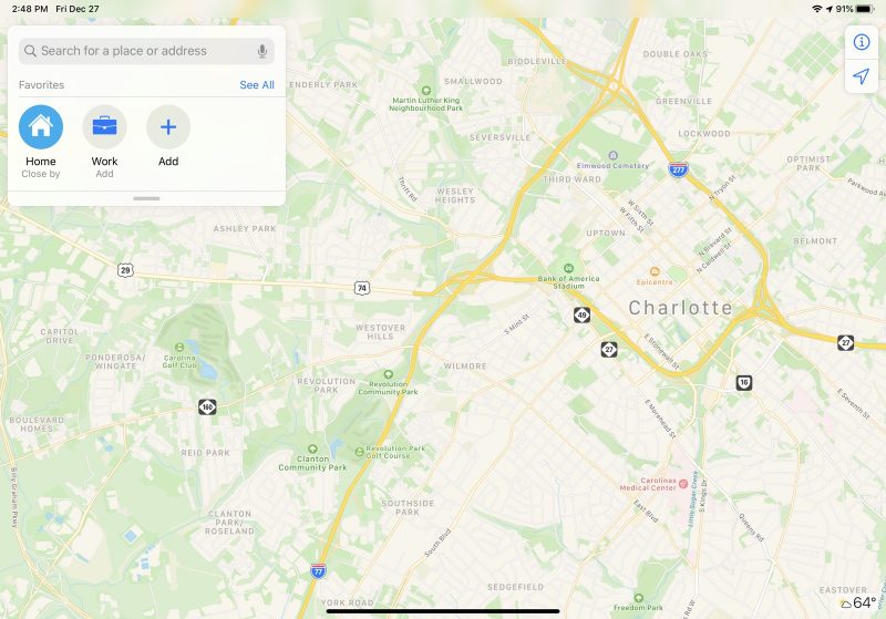
The revamped Maps app features more extensive geographical details, with updated buildings, roads, parks, sports fields, parking lots, foliage, pools, pedestrian pathways, and bodies of water.

To get its mapping data, Apple uses its own vehicles equipped with LIDAR sensors and cameras. Apple has been using this method to collect mapping information for years now.
Apple began rolling out its updated mapping app to customers starting in iOS 12, and at the 2019 Worldwide Developer Conference, Apple said all customers in the United States would receive the improved Maps app by the end of the year.
Apple has made good on that promise with the rollout of the new mapping terrain to large swathes of the United States, and the updated Maps are now available across most of the country. It could still take some time for all users in the Central and Southeastern areas of the U.S. to see the new content.
Apple plans to bring the new Maps app to additional countries in 2020.
(Thanks, @tricil and @NateThompson!)
Tag: Apple Maps
This article, "Revamped Apple Maps Expands to the Southeast and Central United States, Completing Rollout" first appeared on MacRumors.com
Discuss this article in our forums
via MacRumors: Mac News and Rumors - All Stories https://ift.tt/2MBCmJj
No comments:
Post a Comment